
Literary maps
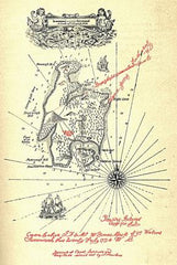
Treasure Island Map
In his book Maps of the Imagination: The Writer as Cartographer, Peter Turchi argues that the relationship between literature and map-making has been unfairly overlooked, and that it may offer scholars a new lens for literary analysis.
Writers, Turchi argues, often rely on imagined landscapes to inspire their narratives. Robert Louis Stephenson's 1881 invention of Treasure Island, for instance, was predated by a painting he drafted of the imaginary locale. It was only after a long contemplation of the image that the author decided to begin work on his famous novel.
The appearance of a printed map in a book can have a similarly important influence on the way we read. In the 1940s, J.R.R. Tolkien commissioned a government cartographer to produce a map of his “Middle Earth”. Pauline Baynes, who had worked in the Ministry of Defence making maps during World War Two, produced a specimen of such high quality that Tolkien felt compelled to recommend her to a friend who had a similar project in mind. Soon afterwards, Baynes had also completed the famous maps of C.S. Lewis's Narnia. Both these maps have come to define reader’s experience of these fantastical worlds. Knowing that there is a diagram tucked inside the back cover, we look closely for place-names so that we can quickly line them up with the picture. Though we might have been fine without it, the map becomes a vital part of the imaginative process as soon as it is present.
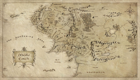
Middle Earth Map
Peter Turchi's Maps of the Imagination is available from Trinity University Press